Wildfire
The simulation of a wildfire using the BEHAVE model and GISSim techniques for the propagation. Some EVOSim techniques are used to represent the extinction model. (video).
All the elements can be defined using VRML or X3D languaje. The simulator uses a default library with the more common elements needed to repesent the simulation model.
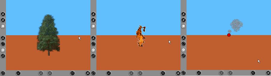
In the next picture, a landscape is shown. This is the initial view of a model, representing the diferent layers that configures the variables. Usually a first layer with the DTM (Digital Terrain Model) is used as a base for all the other layers (vegetation, paths, rivers, etc). Since the model can define different types ofvegetation, different layers representing each one of these layers can be used in the simulation.
|
|
|

Once the model is configured, the simulation can be executed. A least one point is selected, as the origin of the fire. The simulation engine calculates the fire evolution representing the wildfire as can be viewed in the last picture.

This video shows the execution of a wildfire model.
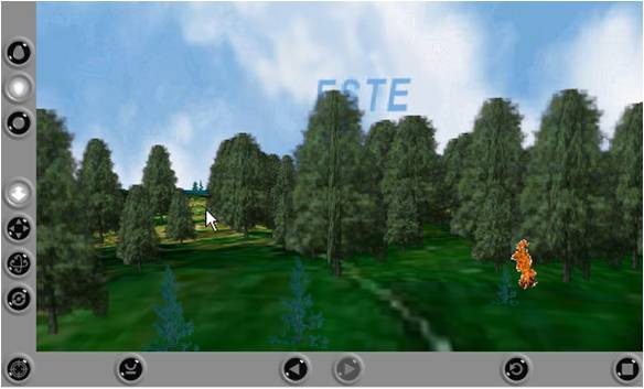
Once the simulation finish the results can be represented in the virtual reality environment.
The virtual reality model is build using VRML with the Cortona browser embedded in the application.
GISRUK 2006
http://www.nottingham.ac.uk/geography/GISRUK/ 5-7h April 2006, University of Nottingham (UK) |
.jpg) |
GISRUK 2004
http://www.geo.ed.ac.uk/gisruk/gisruk.html 28-30h April 2004, University of East Anglia (Norwich) (UK) |
.jpg) |
Pau Fonseca i Casas
Department of Statistics and Operations Research
Universitat Politècnica de Catalunya - BarcelonaTECH
North Campus - C5218 Room
Barcelona, 08034, SPAIN
Tel. (+34) 93 4017035
Fax. (+34) 93 4015855
![]()
![]()
![]()
![]()
![]()
![]()